BDC Grids
The BDC Grid System includes three hierarchical Grids. Currently there are products using two versions of grids, but they are being reprocessed to use Grid Version 2 (V2). The size of the grid tiles varies according to the grid version, see bellow more details. The rationale behind the BDC Grid tiling system follows the concept illustrated below in Figure 14.
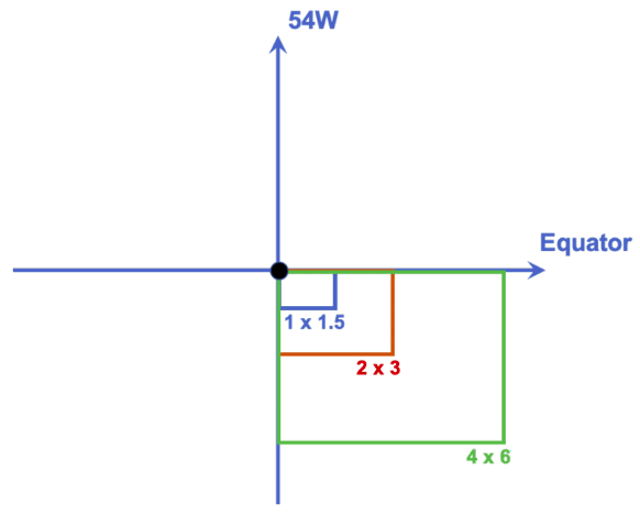
Figure 14 - Tile seeds for BDC Grid.
You can obtain BDC WMS thorugh:
https://brazildatacube.dpi.inpe.br/bdc/geoserver/bdc_catalog/wms
BDC Grid System (V2)
BDC Grid System (V2) includes three hierarchical Grids: 105600m x 105600m (Small, SM), 211200m x 211200m (Medium, MD) and 4224400m x 4224400m (Large, LG) tiles. Each product in BDC is generated using a specific grid, depending on the spatial resolution of the data and the output image size. Sentinel-2/MSI products are generated in the SM grid, Landsat-8/OLI and CBERS-4/MUX are generated in the MD grid and CBERS-4/WFI are generated in the LG grid.
The hierarchical relation between the different BDC Grids (V2) can be seen in Figure 15.
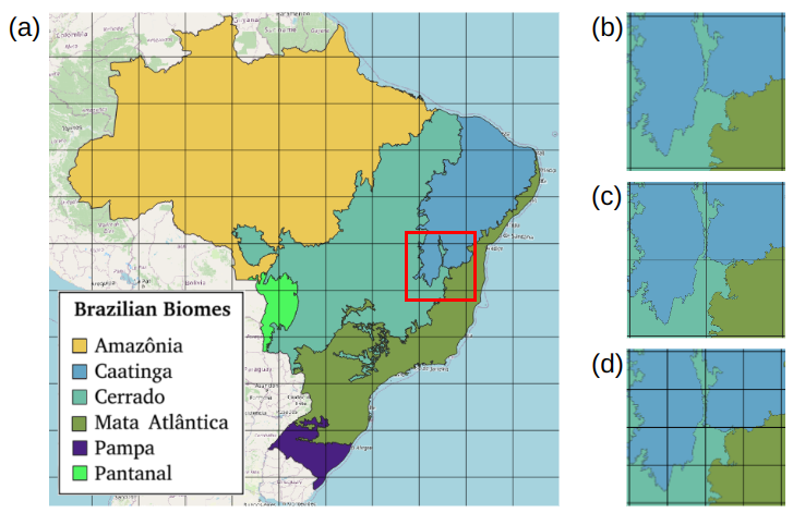
Figure 15 - BDC Grid V2.
You can download the BDC Grid V2 on:
Grid Generation
Tile seeds are initially positioned in a way that the center a tile in the smaller grid is with the meridian 54° west and parallel 12° south. With this initial tile seed defined, other tiles of the same corresponding sizes, always defined by Albers Equal-Area Conic plane coordinates, are automatically generated to entirely cover the cartesian plane of the reference map projection system. For each tile size, upper boundaries perfectly match lower boundaries of tiles above and left boundaries perfectly match right boundaries of tiles on the left. The remaining hierarchical levels are generated using the first grid as a reference.
BDC Grid System (V1)
BDC Grid System (V1) includes three hierarchical Grids: 1.5°x1°, 3°x2°, and 6°x4° tiles. Each product in BDC is generated using a specific grid, depending on the spatial resolution of the data and the output image size. Sentinel-2/MSI products are generated in the 1.5°x1° (SM) grid, Landsat-8/OLI and CBERS-4/MUX products are generated in the 3°x2° (MD) grid and CBERS-4/WFI are generated in the 6°x4° (LG) grid.
The hierarchical relation between the different BDC Grids (V1) can be seen in Figure 16.
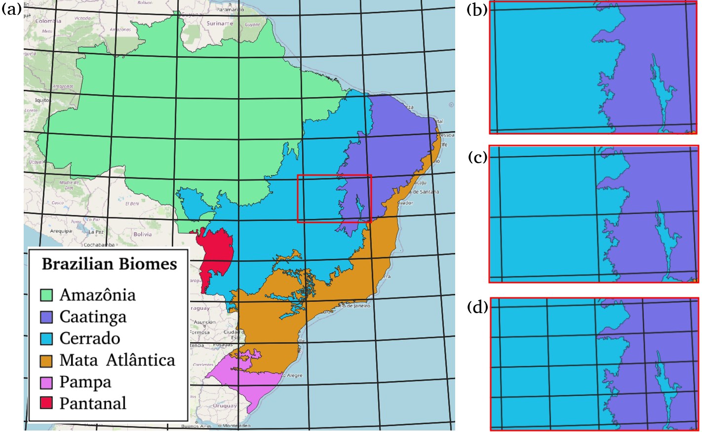
Figure 16 - BDC Grid V1.
Grid Generation
Tile seeds are initially positioned in a way that their upper left corners coincide at the intersection of the equator with the meridian 54° west. With those initial tile seeds defined, other tiles of the same corresponding sizes, always defined by Albers Equal-Area Conic plane coordinates, are automatically generated to entirely cover the cartesian plane of the reference map projection system. For each tile size, upper boundaries perfectly match lower boundaries of tiles above and left boundaries perfectly match right boundaries of tiles on the left.