Retrieving Trajectory
The Python Code snippet 2 shows how to retrieve a trajectory for the location with longitude = -54.0 and latitude = -12.0 for the collection MapBiomas and TerraClass:
1 2 3 4 5 6 7 | import wlts
service = wlts.WLTS('http://brazildatacube.dpi.inpe.br/wlts')
tj = service.tj(latitude=-12.0, longitude=-54.0, collections='mapbiomas5_amazonia,terraclass_amazonia')
tj.df()
|
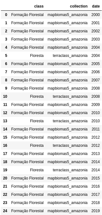
The output of the above code snippet is a dataframe with trajectory of land use and cover as shown in Figure 13:

Figure 13 - Trajectory Plot.