Web Land Trajectory Service (WLTS)
Web Land Trajectory Service (WLTS) is a web service that aims to access and recover trajectories of land use and coverage from different types and data sources.
WLTS brings the concept of Land Use and Cover Trajectories as a high level abstraction. The trajectories of land use and coverage are constructed from a set of classified images (raster or vector) organized over time (Figure 9).
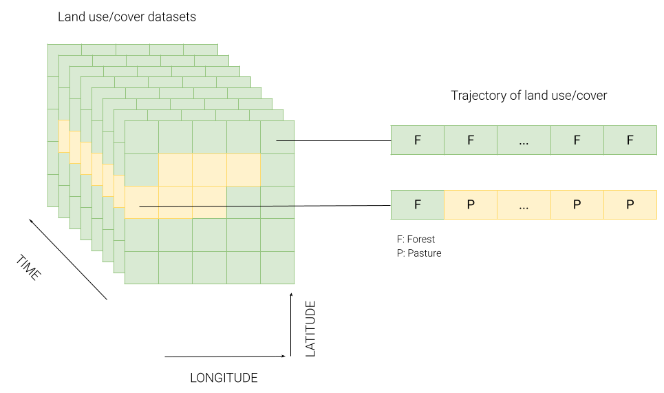
Figure 9 - Land use and cover trajectory.